From Glacial Retreat to the Land of Peat
Ten thousand years in one picture
Take a look a the picture above. What do you notice? Perhaps you see a wide-open area dusted in snow, framed by dense forestlands. Looking closely, you might see small blue bodies of water in the distance, and mountains rising on the horizon. Perhaps you wonder why there aren’t trees in this area. Maybe you wish you had a better view of the mountains to get a closer look at their dramatic, snow-dusted peaks.
By the end of this story, I hope you look at this picture in a new way. Perhaps you will see evidence of a drama that has unfolded over tens of thousands of years. Maybe you will recognize a rare and vital ecosystem that many plants and animals cannot survive without. Perhaps you will see this carpet of sphagnum moss, and excitedly point out the window as you exclaim with glee –– ”That’s a northern peatland! That’s a gigantic field of peat!”
To read this picture with fresh eyes, our story begins in the Ice Age more than 10,000 years ago, when glaciers thousands of feet thick blanketed the Earth.
A final hold-out of a glacier on the Teton Crest Trail in Grand Teton National Park. Captured during the summer of 2014, this glacier is receding each year. It clings to the headwall that it carved in its former glory during the last Ice Age.
Seeing through the eyes of a geologist
When you picture a glacier, what do you see? Do you imagine a dwindling sea of ice winding down a mountain valley? Or a deep blue, seemingly luminescent iceberg floating in the ocean?
If you ask a geologist to describe a glacier, you might get a different image––one filled with motion, drama, and more than a hint of violence.
Glaciers were once Great Lakes-sized tongues of ice carrying hill-sized boulders like pebbles as they slowly scoured the landscape. They devoured mountainsides, grinding them into smooth U-shaped valleys beneath a conveyer belt of rock and ice thousands of feet thick. As Earth’s climate warmed at the end of the Ice Age and glaciers melted, torrents of meltwater cut deep river chasms across the land.
Geologists have honed the ability to read the landscape and look back across thousands of years, visualizing geologic events on timescales that are challenging to comprehend. Using this ability, they read clues on the landscape today to help paint a picture of glaciers in their heyday, carving and shaping the landscape underneath a sea of crushing ice.
Learning to read the landscape like a geologist is kind of like learning a new language. It is challenging at first, but soon it opens doors to understanding the world in a new way.
Glaciers once carved this U-shaped valley on the Crest Trail in Grand Teton National Park.
Looking for glacial evidence in Adirondack Park
Many of the defining features in Adirondack Park were shaped by glacial activity. Iconic mountain profiles, kettle lakes, deep river chasms, and house-sized boulders strewn across the Earth were either carved by glaciers or are the result of glacial melt.
As recently as 10,000 years ago, glaciers were retreating from this landscape at the end of the last Ice Age. As they retreated, they dropped gigantic boulders randomly across the Earth, and torrents of meltwater cut across and through the landscape, creating deep chasms.
Retreating glaciers also left behind depressions in the landscape. These depressions filled with water, and these waterbodies soon blossomed with life, thriving in the warmer climate and nutrient-rich waters.
Over hundreds of years, some of these lakes and ponds transitioned to wetlands as they became more productive, supporting a wide array of plants and animals.
Over thousands of years, dead organic material started to accumulate on the edges and bottom of these water bodies. This growing mass of submerged organic material changed the water chemistry, making it more acidic.
This acidic environment became uninhabitable for many of the microbes that were helping to break down this organic material. Without their help in breaking it down, the rate of decomposition slowed to a snail’s pace. Fewer nutrients were released and recycled back into the ecosystem. Plants that can survive in acidic, wet, and nutrient-poor conditions––primarily sphagnum moss and other bog plants––took over the surface of this wetland.
The rate of organic material accumulation accelerated as the rate of decomposition slowed down, filling the water column from top to bottom. Old organic material was compressed by the weight of new deposits. The carbon and nutrients once held in living tissue are now trapped in this slowly-decomposing mass of organic material––a carbon-rich substance we call peat.
Peat is the building block and defining feature of our Northern Peatlands, and one of the most powerful natural solutions to our biodiversity crisis and our warming climate.
The second-largest northern peatland in New York State stretches across the High Peaks Region of Adirondack Park. A light blanket of snow dusts a carpet of sphagnum moss, black spruce, and sedges, which grow on top of a deep graveyard of submerged, dead, and slowly-decomposing plant material––what we call peat.
Take another look at this image above. What do you see now?
I see tree-covered glacial eskers––ridges left behind by receding glaciers––jutting into an ancient lake bed that has filled with slowly-decomposing plants over the course of thousands of years.
Deep blue springs interrupt an expanse of sphagnum moss covering a northern peatland in the heart of Adirondack Park. An esker of forested, raised land juts into the peatland, additional evidence of glaciers that created this large depression in the landscape that is now one of the largest peatlands in New York State.
I see a nearly two-mile-long blanket of sphagnum moss and bog plants, peppered with black spruce trees and tamaracks. And beneath that blanket, I can picture peat deposits reaching more than thirty feet below the surface in some places, reaching all the way to the bottom of the ancient lake bed that formed as glaciers retreated from this place.
I see one of the most powerful solutions to the challenges we face in the Anthropocene Age.
A closer look reveals a highly textured carpet of sphagnum moss and bog plants. The sphagnum gives a pink hue to the dusting of snow. An esker juts into the peatland on the lower left portion of the photo.
Through peatland conservation and restoration, I see a pathway to preserving and promoting the biodiversity that strengthens the fabric of our planet. I see untapped potential in our planet’s ability to maintain a livable climate. And I see the home of plants and animals that cannot live anywhere else in the world.
These are our northern peatlands. Come explore them with me.
Getting the shot: behind the scenes
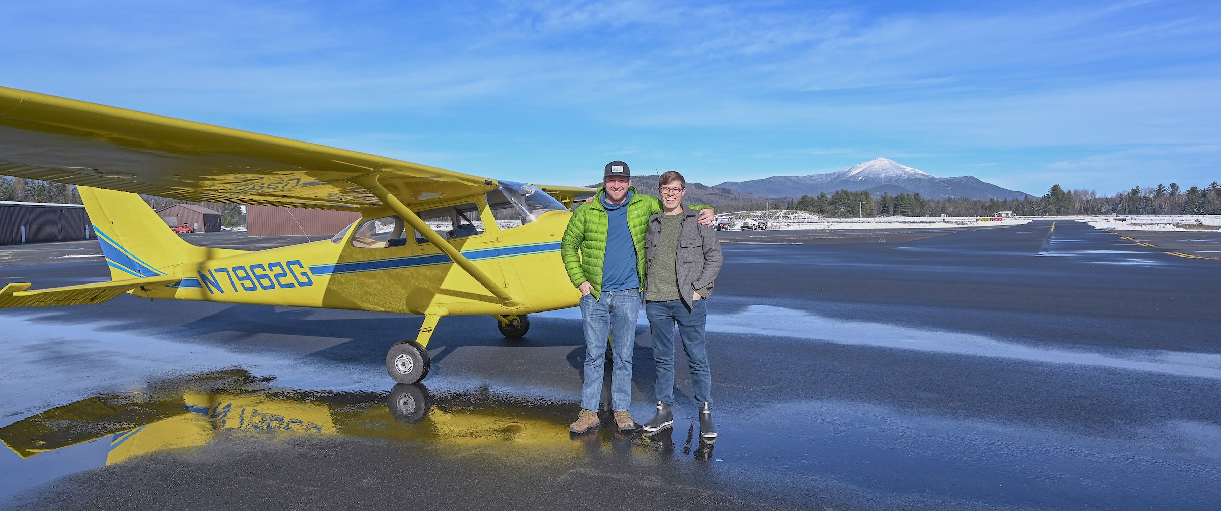
Pilot Chris Dydzulis tows a high-wing plane out of the hanger at the Lake Placid Airport.
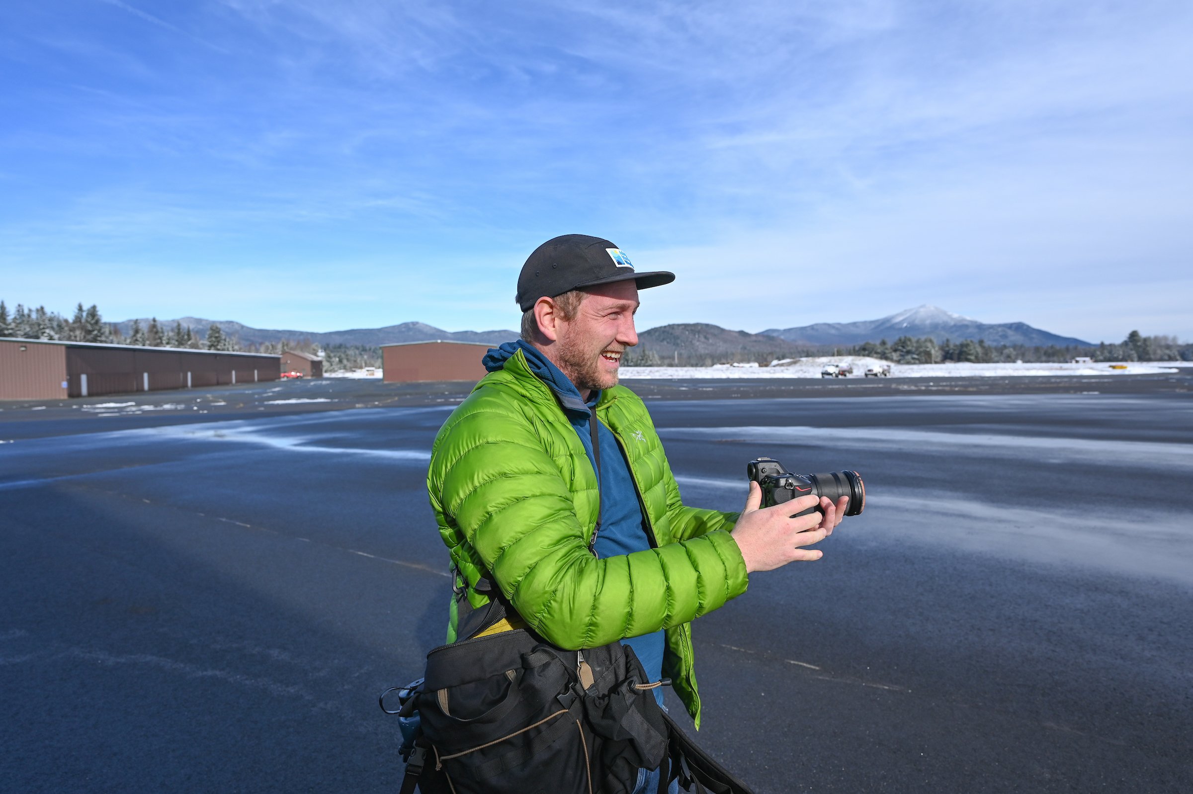
While drone photography has been an indespensable tool to tell the story of our northern peatlands, there were some aerial compositions that remained out of my reach.
Drone operations must remain no higher than 400 feet above ground level. These peatlands stretch more than two miles, and the regulations do not provide enough height above ground to get the perspective I needed to show the scale of this landscape. In addition, the image quality of my professional-grade drone camera still cannot rival the power of my full-frame camera equipment.
I wanted to tell the story of retreating glaciers and shallow lakes, but I couldn’t get the aerial image I needed to truly capture that story without boarding a small plane in the name of peatland conservation.
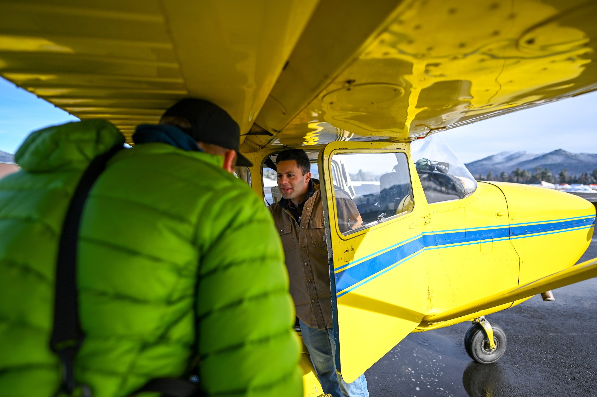
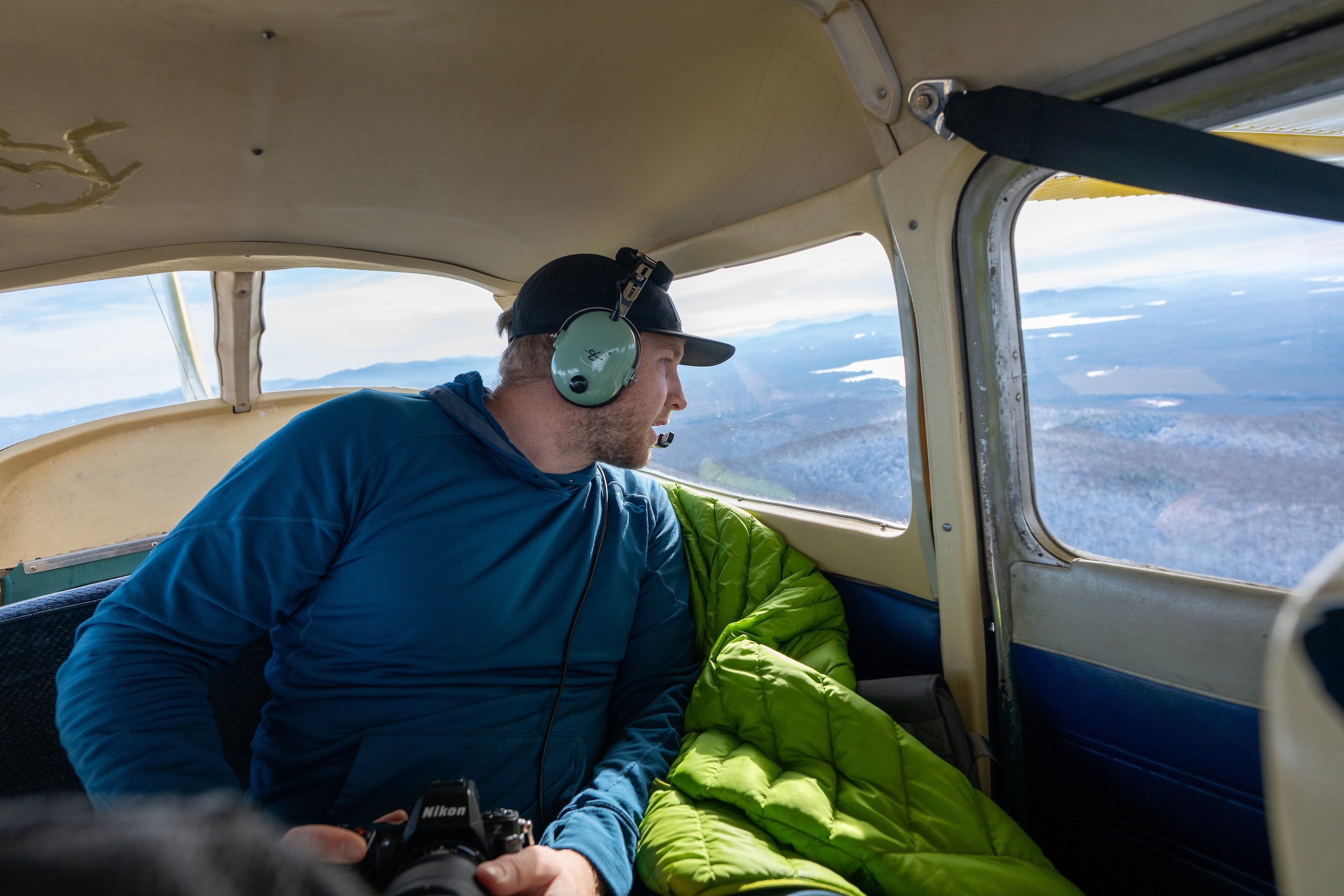
Eric Adsit of Adsit Media prepares to board the high-wing plane, and pilot Chris Dydzulis provides a safety tutorial prior to take-off. Eric volunteered to film the photography flight in an effort to raise awareness of our northern peatlands.
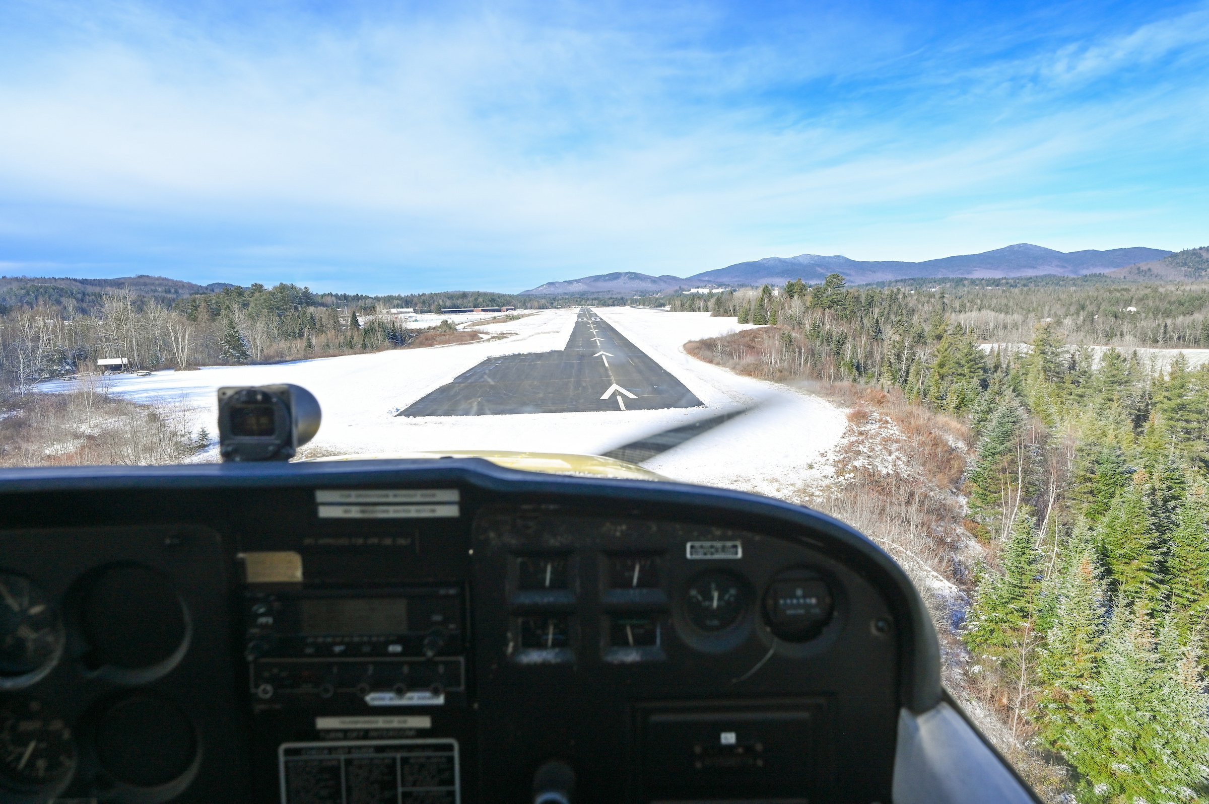
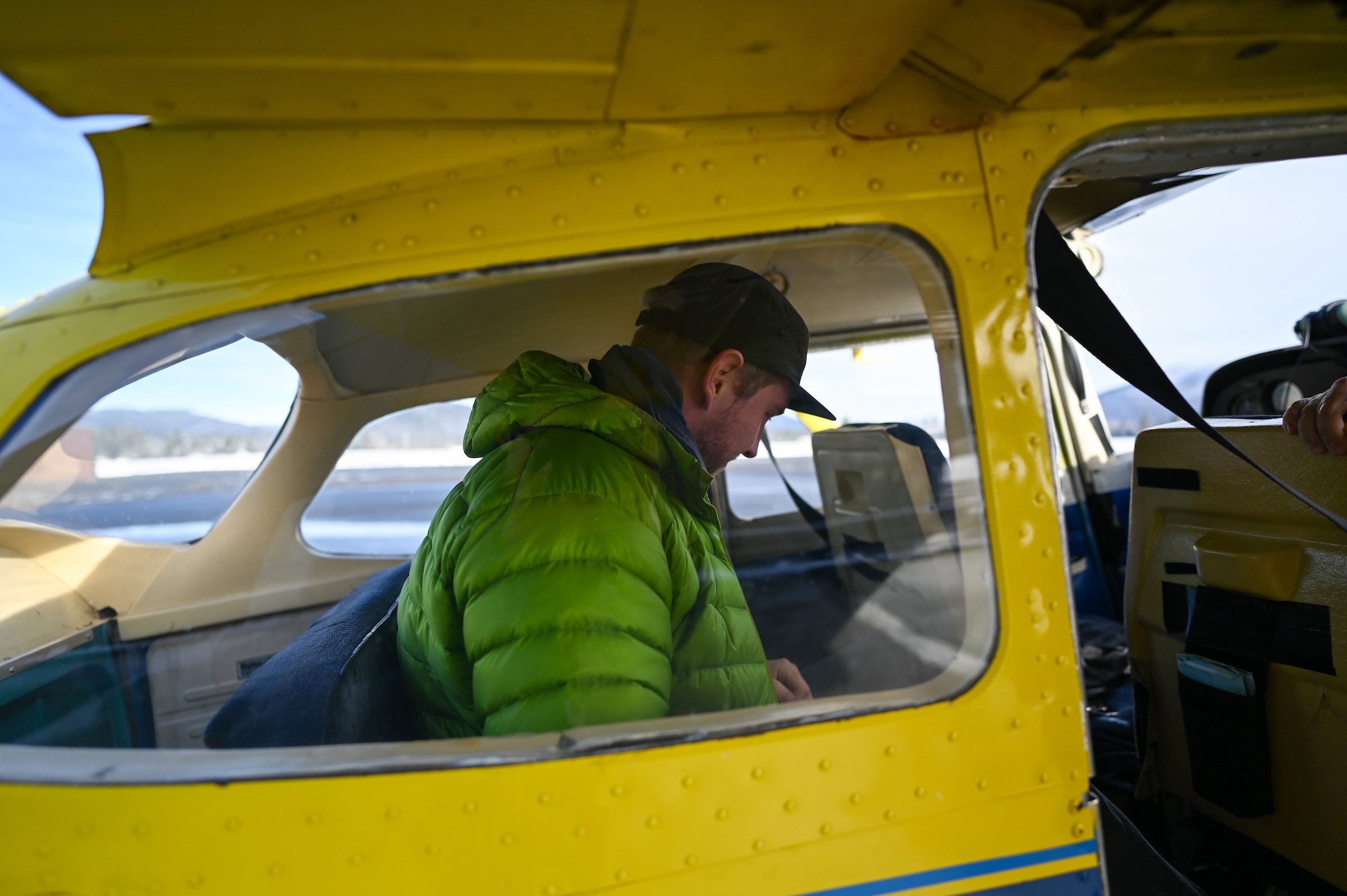
It was a bluebird, November day with crystal clear visibility. An overnight storm system cast a light blanket of snow across the landscape. The warm sun was rising on the horizon. It was a perfect day for a flight over our northern peatlands.
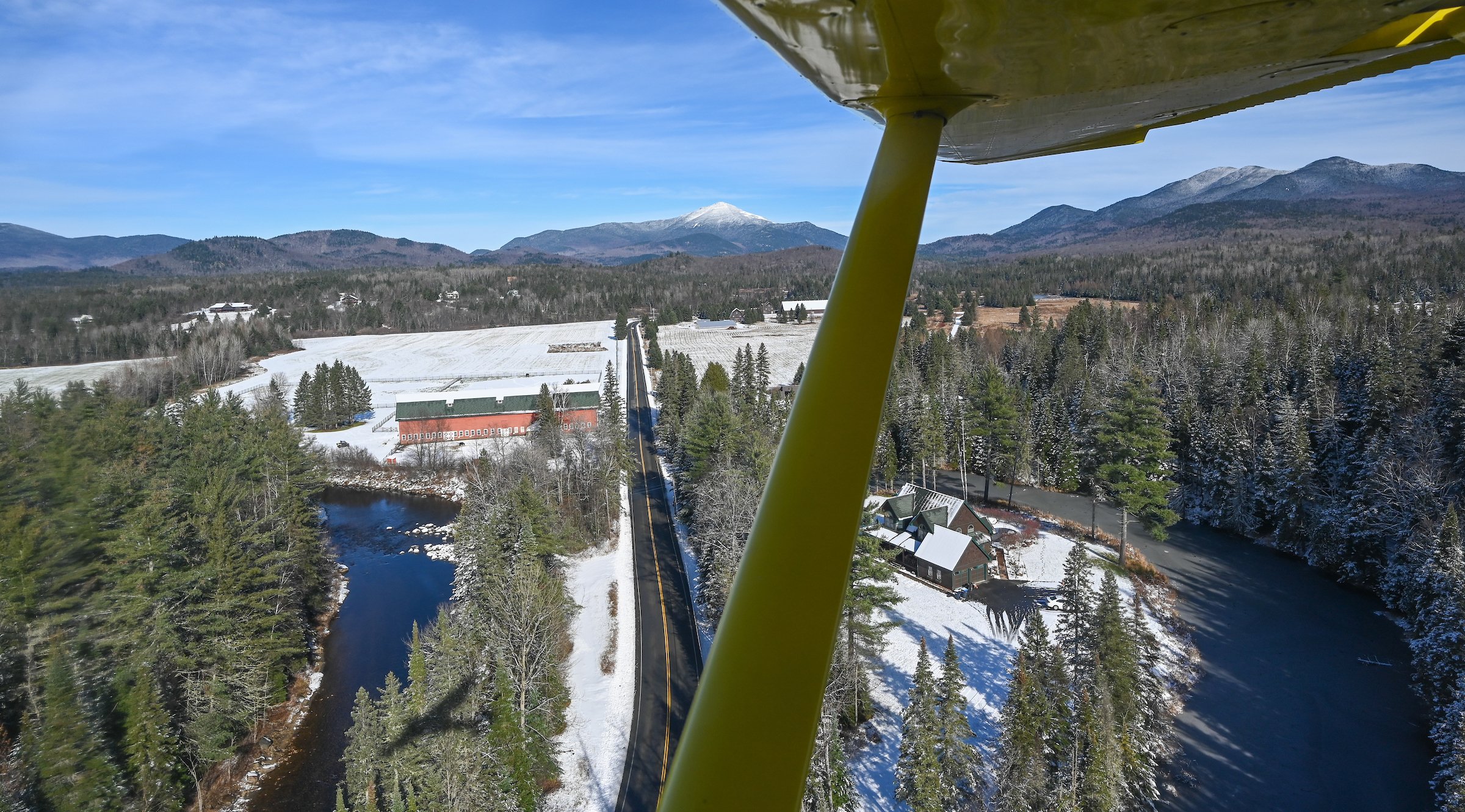
A view over the Olympic Village of Lake Placid on the edge of Mirror Lake, with a snow-capped Whiteface Mountain in the distance.
A confluence of events led to this moment. First, my work on The Northern Peatlands project garnered a sponsorship from Nikon, providing me with equipment that catapulted me into a new realm of imaging quality. Second, I was invited to put together an exhibit that will open on June 7, 2024 featuring my work on The Northern Peatlands Project, and I really wanted to include aerial-perspective shots that are beyond the reach of drone operations. And third, a friend recently connected me with local pilot Chris Dydzulis, who operates high-wing planes for scientific surveys. Three strikes, and I quickly found myself booking a high-wing flight over our northern peatlands to test out the new gear and tell the geologic story behind the formation of these unique ecosystems.
En route to our destination, I was thrilled to find another peatland stretching out below my window. The unmistakable pink hue of sphagnum moss and the treeless expanse immediately drew my attention. I marked this spot, and I’m charting a canoe trip for early summer to take a closer look.
Our destination was a northern peatland that I have explored throughout the seasons and over the years. Despite my familiarity with the area, I found myself completely rewriting everything I knew about this place from these new heights.
Below, you can learn about a few of my discoveries, as well as some of the techniques I used while photographing from the seat of a high-wing plane.
Testing the latest in imaging technology
A sponsorship from Nikon brought me out of the 2018-era flagship mirrorless Z6 into their latest imaging technology with the Z8, as well as various S-series Z-mount lenses.
Working with this camera feels like a new art form.
I am a true believer that you don’t need the best equipment to take award-winning, jaw-dropping images. Talented photographers over the decades have proven it time and time again. However, some types of photographs are simply not possible without the latest equipment.
I wish equipment didn’t matter as much as it does, and that price wasn’t such a barrier to image quality. But the reality is that some images are out of reach if you don’t have the latest and best gear.
Shooting from a high-wing plane, shutter speeds need to be above 1/1000 to ensure crisp images (perhaps faster depending on the length of the lens). The low-light sensitivity of the Z8 allowed me to shoot with incredibly fast shutter speeds without the need to bump my ISO into noise-inducing levels. I could even punch in to a 70 mm or even 200 mm lens length, jump up to the necessary shutter speeds, and still get noise-free, crisp shots I was looking for. It made the photography flight joyful and playful, whereas I would have been fighting the Z6 to get images that––put simply––would not “wow” anyone.
I shot entirely with the Nikkor 20 mm 1.8 S and the Nikkor 70-200 mm 2.8S. The wide angle captured some of the plane in the foreground, and the zoom allowed me to punch into an isolated landscape shot. Both lenses are incredibly fast and crisp edge-to-edge, both important qualities for aerial landscape work. Throughout the flight, our pilot, Chris, put me in perfect position to get the images I was looking for.
Below are a few of the images that would not have been possible without this camera. This tool allowed me to capture a peatland on the edge of winter, in all of its glory.
A spring-fed pond reflects deep blue light in an expanse of rose-tinted sphagnum moss. A layer of snow blankets the scene.
Shooting into the sun reveals skim ice on the small ponds dotting the peatland.
The small dots in the deep blue water are lily pads. Black spruce trees grow upon the sea of moss, and buried beneath it all is a deep basin of partially-decomposed organic material––peat.
A brook winds along the northeastern boundary of a peatland (out of frame). While it is part of the same watershed, this brook does not directly feed into the peatland. Instead, the peatland is fed by springwater and precipitation. Where and how peatlands receive their water determines their chemical properties, which in turn dictates what types of plants will flourish in that habitat.
Acknowledgements
A special thanks to pilot Chris Dydzulis for a smooth and safe flight, and to Eric Adsit for filming the experience. And, thanks to my friends at Nikon and the Nikon Creators program for providing equipment that will help tell the story of our northern peatlands.
The Secret Society of Peatland Enthusiasts is becoming less secret every day. Thanks to you, my readers, for taking the time to get to know this wild and rare ecosystem.